Google Maps launched a bunch of features yesterday to help you get more information about your government’s coronavirus-related regulations. As cities are opening up around the world, authorities are enforcing new rules for public transit to maintain safety and social distancing.
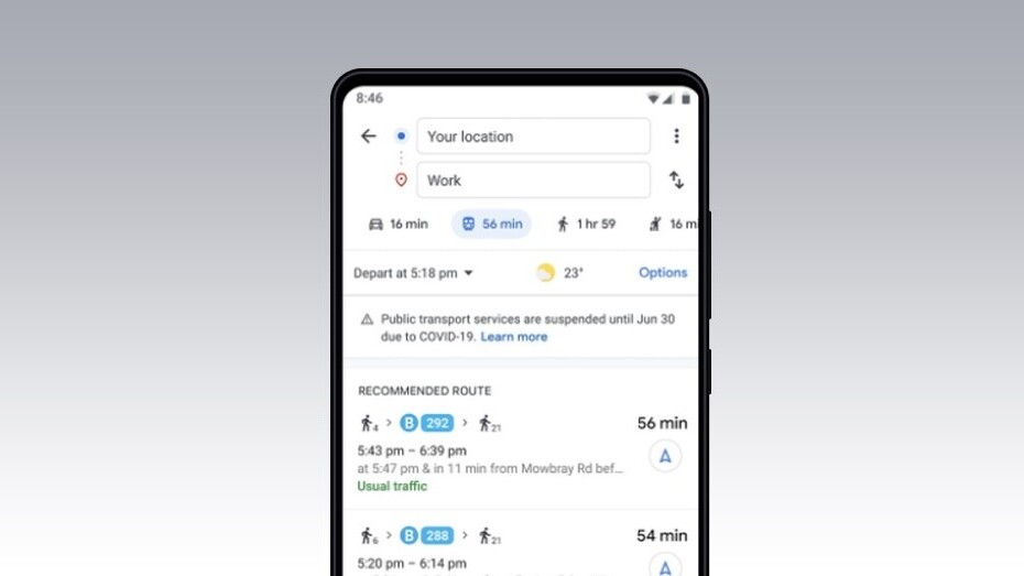
The company says that when you look for public transport options to reach a place on Google Maps, you’ll get alerts and set of requirements — such as if you need to wear a mask — to use these services from local authorities:
These alerts can help you prepare accordingly if government mandates impact transit services or require you to wear a mask on public transportation. Transit alerts are rolling out in Argentina, Australia, Belgium, Brazil, Colombia, France, India, Mexico, Netherlands, Spain, Thailand, United Kingdom, and the U.S. where we have information from local transit agencies, with more coming soon.
Plus, you can also see how crowded public transit routes are based on the time of the day.
Google Maps is also rolling out alerts for routes that might take you across the border such as the US-Canada or the US-Mexico checkpoint, so that you can prepare for COVID-19 restrictions laid out by that country.
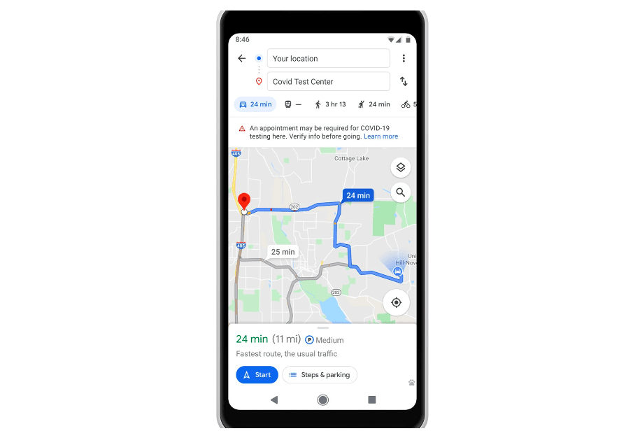
Additionally, if you’re driving to a test center or a medical facility, Maps will tell you if you need to make a prior appointment to get tested. That’s useful if these centers are turning down requests that don’t match certain pre-requisites.
These features are rolling out to Google Maps on both iOS and Android. You can read about all the announcements here.
Get the TNW newsletter
Get the most important tech news in your inbox each week.